.svg)

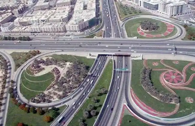
The most important roads, axes and bridges in the city of New Cairo ( New Cairo City )
The most important roads, axes and bridges in the city of New Cairo ( New Cairo City )
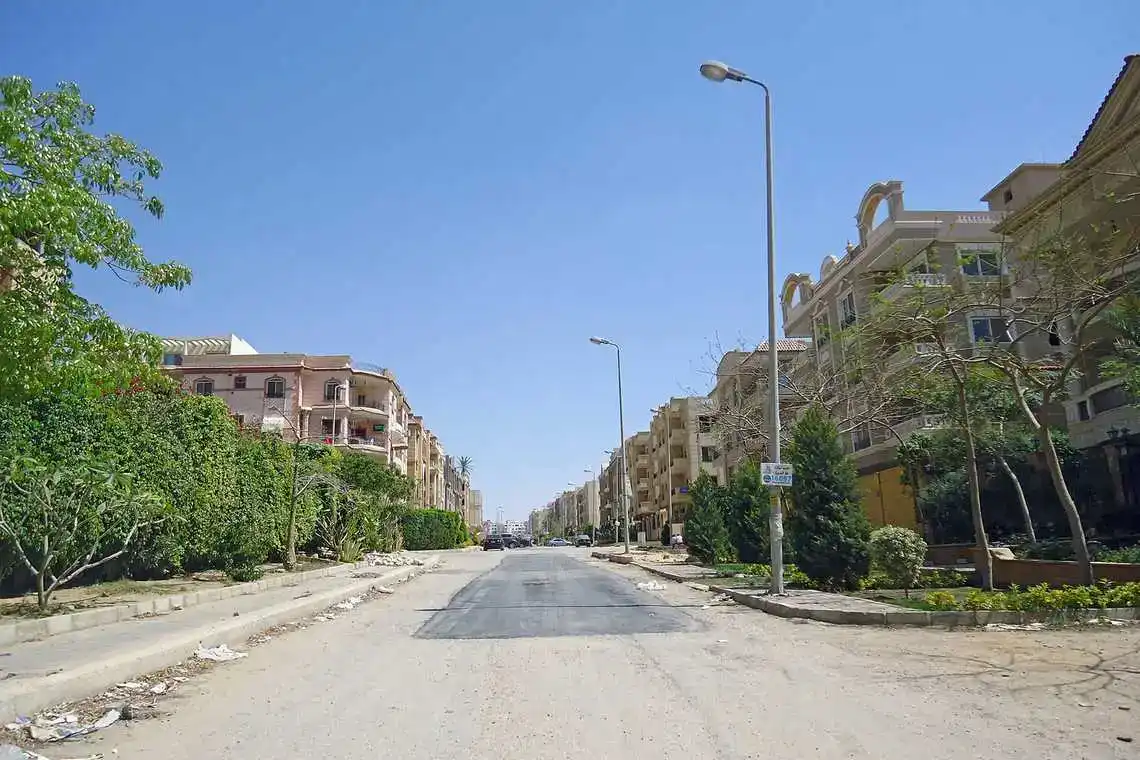
New Cairo City is one of the third generation cities located in the east of Cairo Governorate. The city is distinguished by its distinguished location among the cities of Cairo, as it is close to the New Administrative Capital, Nasr City, Heliopolis, and Madinaty. Its area is estimated at about 70,000 acres. The city is administratively affiliated to the New Urban Communities Authority. The city's height above sea level is 180 meters, and therefore it is characterized by a moderate climate. The city is connected to other cities and governorates through a group of main roads, which facilitates the movement of residents. Examples of important roads in New Cairo include:
Suez Road
The Cairo-Suez Desert Road, also known as the Egypt-Suez Desert Road, is a "free road". It is considered one of the main roads in the Arab Republic of Egypt, linking the Suez Road between Cairo Governorate and Suez Governorate, where it ends at the entrance to the Suez Canal, with a length of about 106 km at the time of construction. The Suez Road has been developed and provided with a number of bridges, as follows:
Army Bridge
Army Bridge
Gardena bridges
Supporting road bridges
Bridge intersection of Cairo / Suez road with the ring road
Cairo / Suez road intersection bridge with the mass transit station
New Cairo Bridge
Family Garden Bridge
El Shorouk Bridge
Ring road ( New Cairo City )
The Ring Road is a peripheral road built around Greater Cairo to connect the three governorates of Greater Cairo, and to reduce traffic congestion within Cairo Governorate and its suburbs, as the traffic on it reaches more than 100,000 cars per day. The Ministry of Housing started constructing the ring road in 1986 and it was completed in 2005 with a total length of 100 km upon delivery. The road has two lanes in each direction, but the ring road has been significantly expanded in the past two years. The General Authority for Roads and Bridges received the ring road and started developing it until it became three lanes in each direction from Kattameya to Suez and four lanes in the rest of the road.
The Ring Road in Greater Cairo is surrounded by: the Middle Ring Road and the Regional Ring Road. The three roads form rings surrounding one another around Greater Cairo. They represent new traffic axes for Greater Cairo and its suburbs.
Axis of Marshal Tantawi NA ( New Cairo City )
Al-Moshir Axis connects New Cairo, Nasr City, and the Ring Road. It was inaugurated in May 2012 under the name "Axis NA" and then its name was changed in November 2012 to become Axis Al-Moshir Tantawy
Ain Sokhna Road ( New Cairo City )
The Cairo-Ain Sukhna Road or "Katameya Road - Ain Sukhna" is a free road and one of the main roads in the Arab Republic of Egypt.
It connects the governorate of Cairo with the city of Ain Sukhna in the Suez governorate, with a length of about 88 km. It is currently managed by the National Company for Road Construction and Development
Middle Ring Road ( New Cairo City )
The Middle Ring Road is a circumferential road in Egypt located between the Greater Cairo Ring Road and the Regional Ring Road. The road forms an open circuit around Cairo. It extends from the “Cairo-Belbeis Road” and reaches the “Al-Dabaa Corridor” with a total distance of 147 km, until it connects the new cities (Obour City, Al-Shorouk City, Al-Mustaqbal City, the Administrative Capital City, 6th of October City, Sheikh Zayed City).
Regional Ring Road ( New Cairo City )
This road intersects with the Cairo-Suez Desert Road and provides easy access to the city of New Cairo. This road is considered the longest in Africa and the Middle East at the time of its construction, with a length of 400 km. The regional ring plays a key role in linking the main highways in Greater Cairo, as it is considered the new artery of new cities.
Southern Ninety ( New Cairo City )
Southern Teseen Street in Fifth Settlement is the central axis of New Cairo. The length of the southern ninetieth is about 23 kilometers. It was given this name in relation to the width of the street, which reaches ninety meters.
The Southern 90 starts at the end of NA Road "Axis of Field Marshal Tantawi" at the ascent of the Ring Road, and passes through the Choueifat neighborhood, Al Narjis neighborhood, then the Southern Investors neighbourhood, to the Lotus neighborhood, then the Northern 90 Street until it reaches Ismailia Road, and goes to the Southern 90 near the beginning of Al Ain Road Sokhna.
Northern Ninety ( New Cairo City )
North Teseen Street in the Fifth Settlement is the second central axis of New Cairo after South Teseen and is parallel to it.
North 90th Road starts after Cairo Festival City Mall and Downtown Mall, passing through the area south of the Police Academy, Al-Yasmeen neighborhood, Al-Banafseg neighborhood, Northern Investors, then the Al-Kronfol area, reaching Beit Al-Watan and Suez Road.
Muhammad Najeeb Axis ( New Cairo City )
The Mohamed Naguib Corridor was constructed with a length of 13 km in New Cairo. It starts from Suez Road to Ain Sokhna Road. It is one of the important traffic hubs in the city. It passes through the following three gatherings: - The first assembly - The fifth assembly - The third assembly. The last part of the intersection of the Mohamed Naguib axis with Ain Sokhna Road up to the Central Ring Road is now being completed.
Talaat Harb Axis ( New Cairo City )
Talaat Harb axis connects the third district in the Fifth Settlement with Fatima Al-Sharbatly Square, and reaches even the youth housing in the Third Settlement. It is currently being linked to the old Ain Sukhna road.
Gamal Abdel Nasser Axis ( New Cairo City )
The Gamal Abdel Nasser axis connects the road between the Golf Tunnel and Arabella Square in New Cairo.
El-Amal Axis ( New Cairo City )
The Axis of Hope is the road separating the Choueifat neighborhood and Al Ahyaa district in the Fifth Settlement.
The axis of hope also connects between the southern 90th Street and the axis of Gamal Abdel Nasser, and it reaches to the Katameya Heights compound and the West Golf neighborhood to the Triumph Hotel.
Mostafa Kamel Axis ( New Cairo City )
The Mustafa Kamel axis connects the northern 90th road with Abbas Al-Akkad axis and Youssef Al-Sibai axis.

Leave Comment
Be Successful In Today's Market.